As part of the state’s 2026 school traffic safety law sometimes referred to as Liam’s Law, a new type of roadway called “safe routes to school” was created. The state defines these roadways as those that are “frequented by pedestrians and bicyclists on their way to and from a nearby school that a… municipality designates to increase pedestrian and bicyclist safety.”
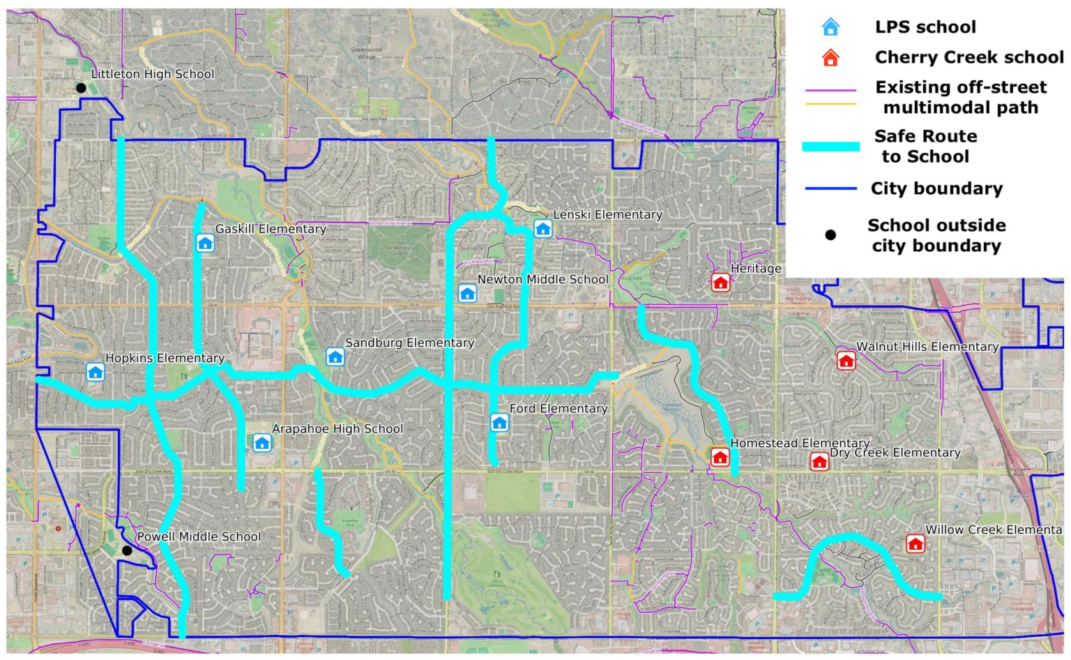
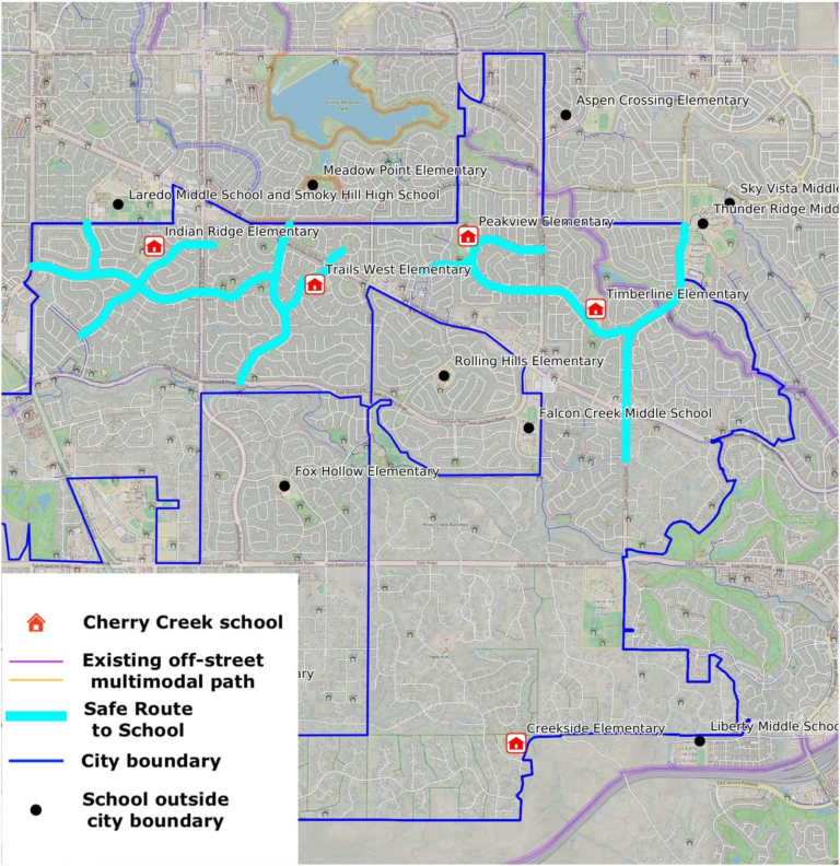
The roadways in our ordinance were chosen for safe routes to schools based on their proximity to schools, existing infrastructure, school enrollment boundaries, and need for a safe route via roadway if there is a lack of existing multimodal pathways. As part of our ordinance, a school street, which was also a new type of roadway defined by the 2026 state law, will be mandatory at each school. School streets will be further defined by the Safe Routes to School Program so they make sense for Centennial neighborhoods.
Take a look at the proposed routes below. This is just the beginning for our program. See anything missing? Let us know in the comments or send us a message!